Updated September 9, 2023 at 8:54 PM ET
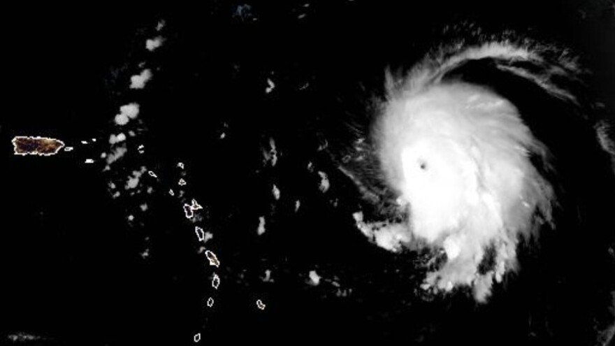
Hurricane Lee was downgraded early Saturday to a Category 3 storm with maximum sustained winds near 115 mph. But the National Hurricane Center said Lee is expected to remain a "powerful hurricane" over the next few days as its impacts are expected to be felt across the Caribbean.
Lee is forecast to move well north of the Leeward Islands, the Virgin Islands and Puerto Rico beginning this weekend and into the coming week.
No coastal watches or warnings were in effect as of Saturday afternoon. But the hurricane's sheer power is expected to bring dangerous beach conditions to Puerto Rico, the Bahamas and the Turks and Caicos over the weekend.
Lee will likely produce similar dangerous surf conditions in the East Coast starting Sunday, but it remains unclear how serious its impacts will be over the region. While the hurricane's winds are forecast to "considerably" diminish in the coming days, Lee's intensity is expected to fluctuate.
All eyes are on the storm's path

So far, the storm isn't posing an immediate threat to anyone on land. But experts advise keeping a close eye on the storm.
"It is way too soon to know what level of impacts, if any, Lee might have along the U.S. East Coast, Atlantic Canada, or Bermuda late next week, particularly since the hurricane is expected to slow down considerably over the southwestern Atlantic," the NHC's John Cangialosi wrote in his discussion of the forecast.
There is a chance Lee might not make landfall anywhere. Several long-range models predict Lee will curve north — missing islands along the Caribbean and staying clear of the U.S. mainland. While models are generally accurate, they're not perfect. In 2017, Hurricane Irma was supposed to follow a similar path — but it wound up smacking Florida's Gulf coast.
Warm waters are intensifying Lee
The system has gained power passing over "record-warm waters of near [86 degrees Fahrenheit] east of the Lesser Antilles," the NHC said, adding that such warm waters are more likely to be found in the Gulf of Mexico, not the Atlantic Ocean.
The frequency of intense and damaging tropical storms and hurricanes have been linked to climate change. As NOAA has stated, "Warming of the surface ocean from human-induced climate change is likely fueling more powerful tropical cyclones."
The storms' destructive power is then magnified by other factors related to global warming, from rising sea levels to more intense rainfall totals.
Form not loading on your device? Click through to share your thoughts.
Copyright 2023 NPR. To see more, visit https://www.npr.org.


